
East Smithfield (note: West Smithfield is in the City of London, beside St Bartholomew's Hospital)
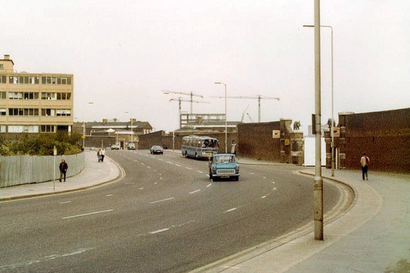
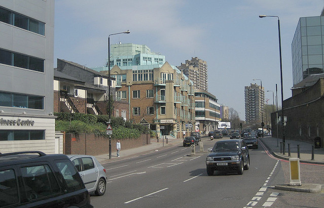 Seen left in the 1970s and today, and now a
busy and nondescript stretch of road (A1203) between The Highway and The
Tower of London - on London Marathon and Triathlon routes - East
Smithfield (derived from smooth-field?) was
once the name of the whole area between Aldgate and the Tower, and
has a complex history. The area north of the Highway fell successively into the parishes of St Botolph Aldgate, St Mary Matfelon
(Whitechapel), St Mark Whitechapel and St Paul Dock Street before
becoming part of St George-in-the-East. South of The Highway, most of
it (the St Katharine's area) was part of the parish of St John
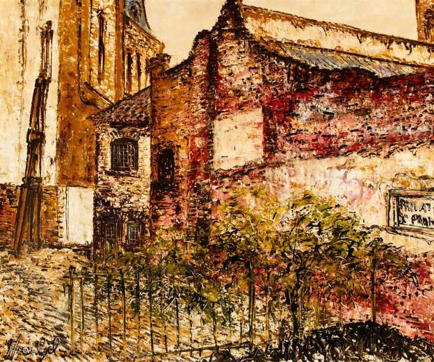
Wapping and now is part of St Peter Wapping. Right is a 1975 oil painting by Noel Gibson of 1 East Smithfield.
Seen left in the 1970s and today, and now a
busy and nondescript stretch of road (A1203) between The Highway and The
Tower of London - on London Marathon and Triathlon routes - East
Smithfield (derived from smooth-field?) was
once the name of the whole area between Aldgate and the Tower, and
has a complex history. The area north of the Highway fell successively into the parishes of St Botolph Aldgate, St Mary Matfelon
(Whitechapel), St Mark Whitechapel and St Paul Dock Street before
becoming part of St George-in-the-East. South of The Highway, most of
it (the St Katharine's area) was part of the parish of St John
Wapping and now is part of St Peter Wapping. Right is a 1975 oil painting by Noel Gibson of 1 East Smithfield.
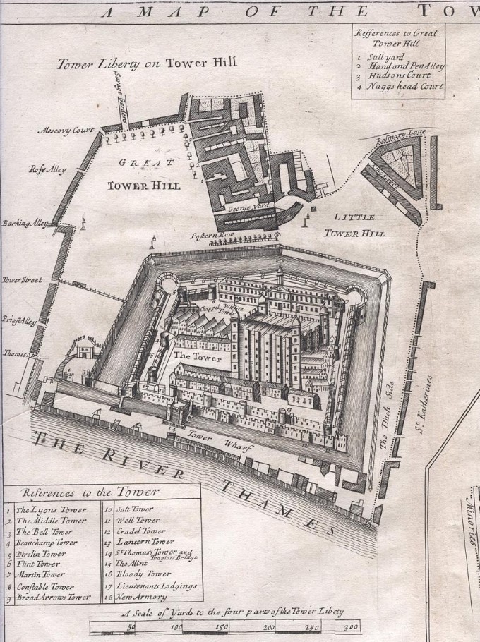
Early history
According
to John Stow's Survey of London (first edition 1598), the Saxon king
Edgar granted the wasteland to the east of the city wall to a guild
of 13 knights, on condition that each should accomplish
three combats, one above the ground, one below the ground, and the
third in the water; after this, at a certain day in East Smithfield,
they should run with spears against all comers; all of which was
gloriously performed; and the same day the King named it Knighten
Guilde, and so bounded it from Ealdgate [Aldgate] to the place where
the bars now are toward the east, &c. and again toward the south
unto the river of Thames, and so into the water, and throw his
speare; so that all East Smithfield, with the right part of the
street that goeth by Dodding Pond into the Thames and also the
hospital of St Katherin's, with the mills that were founded in King
Stephen's daies, and the outward stone wall, and the new ditch of the
Tower, are of the saide fee and liberbertie.
Edward the Confessor, and William II
(Rufus) confirmed this 'liberty' (a building-free area defined by the distance an arrow could be fired from the Tower).
By 1115, in the reign of Henry I,
the wider liberty, or soke, fell to the priory church of Holy Trinity
within Aldgate, founded in 1107 by his wife Queen Matilda (Edith) of
Scotland, with the prior sitting as an Alderman of London. (A tussle
resulted when Geoffrey de Mandeville, Constable of the Tower, used its garrison to defend his vineyard on land by the Tower.) In
1147, the priory built the Hospital of St Katharine under the
patronage of Mathilda (Maud) of Boulogne, wife of king Stephen; ever
since, the foundation has prayed daily for the repose of her soul. With
further foundations by Eleanor (widow of Henry III) and Philippa
(wife of Edward III) the area south of the present-day main road
became the Precinct of St Katharine, holding a 15-day fair at Pentecost from
1229. From 1236 until their expulsion in 1290, Jews settled in the
area, under the protection of the Tower garrison.
Meanwhile, in 1294 the Liberty of the Minories was created around the Minoresses of St Mary (of the Order of St Clare) - more details here - in the area which is now Tower Gateway DLR. The Liberty of Wellclose, around the Abbey of St Mary Grace, was also formed, and constituted in 1442 as a Precinct free from jurisdiction civil or ecclesiastical, except that of the Lord Chancellor. In 1686 all these areas were consolidated into the Liberties of the Tower of London. The peculiarties of jurisdiction remained: as late as 1831, James Elmes Topographical Dictionary of London and its environs (Whitaker, Treacher & Arnott) reports that in the liberty of East Smithfield a courtleet and court-baron are held, wherein pleas to the amount of forty shillings are held, nuisances presented, and of similar judicial acts. However, from 1855 the whole East Smithfield area fell under the administration of the local Magistrates' Court.
Black Death burial grounds and St Mary Grace's Abbey
 St Mary
Grace's Abbey,
sometimes known as Eastminster, was the only new
Cistercian foundation in the 14th century (it was subject to the
monastery at Beaulieu). [Grace's Alley, off Wellclose Square,
perpetuates the name.] It was founded by Edward III in 1350, and was
unusual in having an urban setting. It was established in the
aftermath
of the Black Death of 1347-51, adjacent to two emergency burial
grounds, and had a relatively short life, as it was suppressed in 1539. An old map shows a river
running down
each side of Nightingall Lane [now Thomas More
Street], in
Wapping. It has been suggested that this was one of
London's lost rivers and
ran from Well Street into the Thames. Archaeological investigations of the whole site, including
the abbey and the burial grounds (and of the later victualling yard), were carried out between 1983-88. Three-quarters
of the abbey site were explored, including parts of the church and
presbytery (with 131 clergy and lay burials), the chapter house,
refectory, infirmary and kitchen; its layout was a cross between that
of older foundations and the pattern that had developed for friars'
housing in the 14th century.
St Mary
Grace's Abbey,
sometimes known as Eastminster, was the only new
Cistercian foundation in the 14th century (it was subject to the
monastery at Beaulieu). [Grace's Alley, off Wellclose Square,
perpetuates the name.] It was founded by Edward III in 1350, and was
unusual in having an urban setting. It was established in the
aftermath
of the Black Death of 1347-51, adjacent to two emergency burial
grounds, and had a relatively short life, as it was suppressed in 1539. An old map shows a river
running down
each side of Nightingall Lane [now Thomas More
Street], in
Wapping. It has been suggested that this was one of
London's lost rivers and
ran from Well Street into the Thames. Archaeological investigations of the whole site, including
the abbey and the burial grounds (and of the later victualling yard), were carried out between 1983-88. Three-quarters
of the abbey site were explored, including parts of the church and
presbytery (with 131 clergy and lay burials), the chapter house,
refectory, infirmary and kitchen; its layout was a cross between that
of older foundations and the pattern that had developed for friars'
housing in the 14th century.

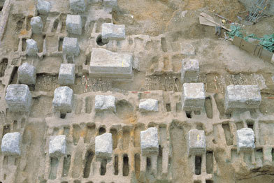 As
for the
two burial grounds, there were probably over 2,400 burials (with
perhaps 200 a day at the height of the plague), and evidence of 759 was
found, both in
individual graves and in mass trenches, with bodies five deep. DNA
samples from 53 bones and 43 teeth were taken, and the whole project
was valuable in confirming burial practice, and in
demonstrating that the weak and malnourished were the most likely
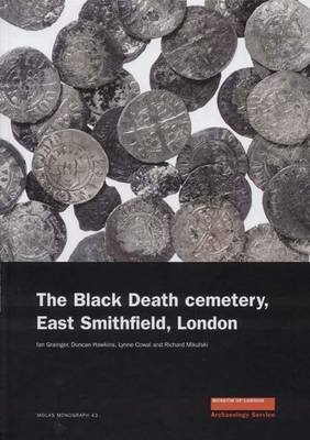
victims. See further Ian Grainger, Duncan Hawkins, Lynne Cowal & Robert Mikulski The Black Death Cemetery, East Smithfield (MOLAS monograph 43, Museum
of London Archaeology Service 2008) and Ian Grainger & Christopher Philpotts The Cistercian Abbey of St Mary Graces, East Smithfield, London (MOLAS monograph 44, Museum of London Archaeological Service 2011).
As
for the
two burial grounds, there were probably over 2,400 burials (with
perhaps 200 a day at the height of the plague), and evidence of 759 was
found, both in
individual graves and in mass trenches, with bodies five deep. DNA
samples from 53 bones and 43 teeth were taken, and the whole project
was valuable in confirming burial practice, and in
demonstrating that the weak and malnourished were the most likely
victims. See further Ian Grainger, Duncan Hawkins, Lynne Cowal & Robert Mikulski The Black Death Cemetery, East Smithfield (MOLAS monograph 43, Museum
of London Archaeology Service 2008) and Ian Grainger & Christopher Philpotts The Cistercian Abbey of St Mary Graces, East Smithfield, London (MOLAS monograph 44, Museum of London Archaeological Service 2011).

 When
Henry VIII dissolved the
monasteries in 1531, much of the land in the area was taken by the
Crown and - with the exception of St Katharine's - was given to
prominent nobles. On 28 May
1541 Margaret Pole,
Countess of Salisbury, was martyred on 'East
Smithfield Green' (now Tower Green, within its precincts). Haiward and
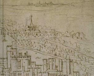
Gascoyne's 1597 map shows East Smith Field (formerly Piece) on the
north-east of the Tower; the map of 1755 describes it as Little Tower
Hill.
When
Henry VIII dissolved the
monasteries in 1531, much of the land in the area was taken by the
Crown and - with the exception of St Katharine's - was given to
prominent nobles. On 28 May
1541 Margaret Pole,
Countess of Salisbury, was martyred on 'East
Smithfield Green' (now Tower Green, within its precincts). Haiward and
Gascoyne's 1597 map shows East Smith Field (formerly Piece) on the
north-east of the Tower; the map of 1755 describes it as Little Tower
Hill.
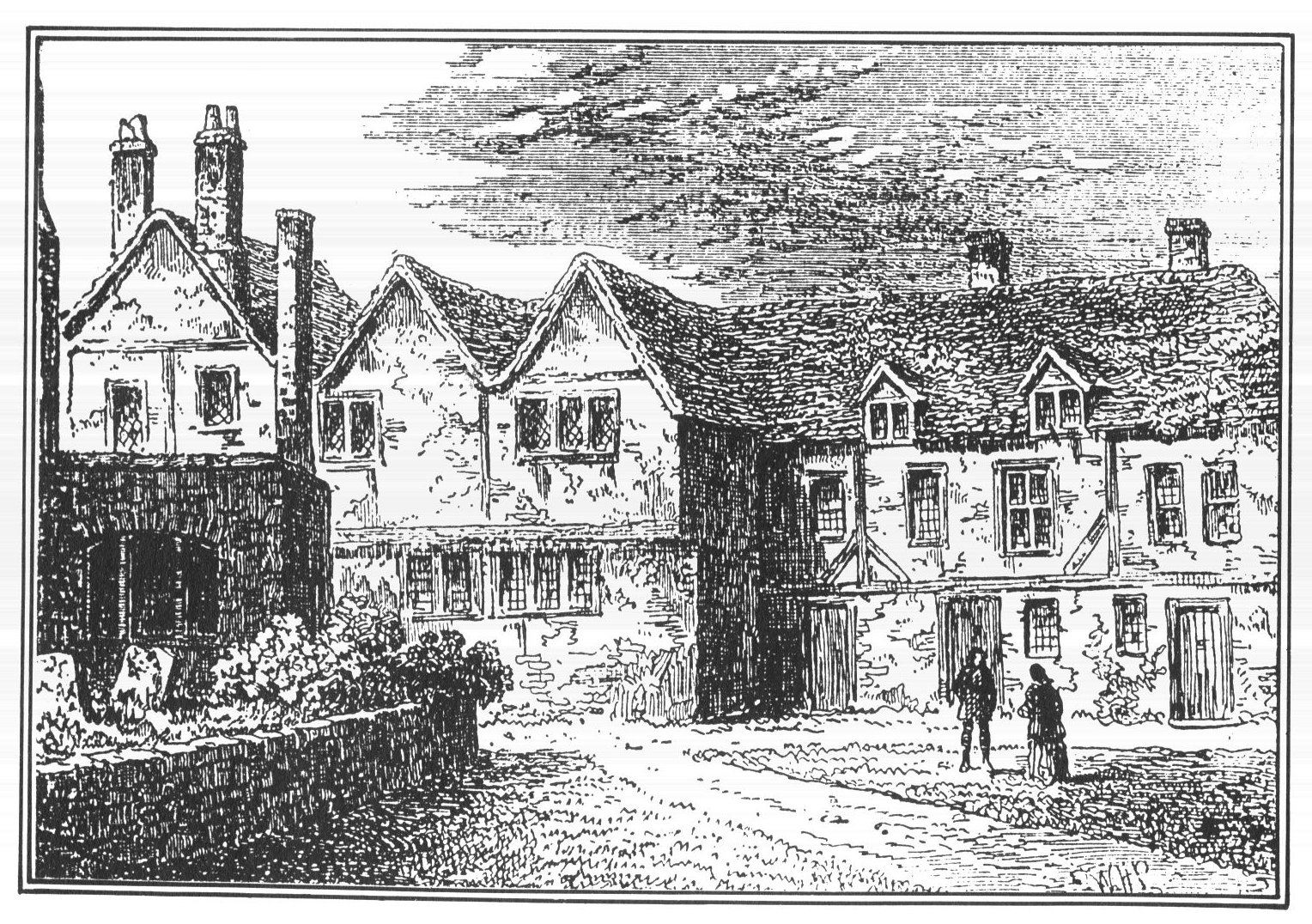
Hospital of St Katharine (continued)
Because of its
long-standing royal connections, the Hospital of St Katharine was
not seized, but was re-established as a Protestant house. The site had for some time been associated with brewing: see this 1911 account, from the article on 'Brewing' in A History of the County of Middlesex (vol 2, pages 168-78):
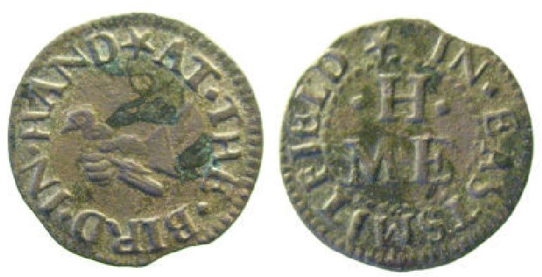
 See below for the later history of the Red Lion Brewery. Local pubs were a key part of the trading economy, and were among those who issued their own tokens; left is a 17th century halfpenny token issued by 'MEH' at the Bird in Hand
in East Smithfield, and a mid-17th century farthing token issued by
John and his wife S. Clark of Ratcliff Highway (there are many more
examples on coinage websites; see here for other local specimens). Because
foreign ships were barred from City wharves, they tended to unload at St
Katharine's Quay (Dutch ships in particular). Many French also settled here, after England lost Calais in 1558; part of the Precinct known as Hangman's Gains took its name from the areas of Hammes and Guisnes. With trade in
the City regulated by the City, St Katharine became an area for
foreign settlement. See here for the building of St Katharine's Docks in 1828. Right is a 1781 drawing of the Brothers' House which was demolished at that time.
See below for the later history of the Red Lion Brewery. Local pubs were a key part of the trading economy, and were among those who issued their own tokens; left is a 17th century halfpenny token issued by 'MEH' at the Bird in Hand
in East Smithfield, and a mid-17th century farthing token issued by
John and his wife S. Clark of Ratcliff Highway (there are many more
examples on coinage websites; see here for other local specimens). Because
foreign ships were barred from City wharves, they tended to unload at St
Katharine's Quay (Dutch ships in particular). Many French also settled here, after England lost Calais in 1558; part of the Precinct known as Hangman's Gains took its name from the areas of Hammes and Guisnes. With trade in
the City regulated by the City, St Katharine became an area for
foreign settlement. See here for the building of St Katharine's Docks in 1828. Right is a 1781 drawing of the Brothers' House which was demolished at that time.
Royal Navy Victualling Yard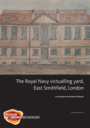 Established in 1560 on the site of St Mary
Grace's Abbey and the two former burial grounds, it used some of the
former abbey buildings (which later caused problems). Ships' biscuits
were made here, and in 1654 (when the diarist Samuel
Pepys was working for the Navy) it became the main London Victualling
Office,
covering a 5-acre site. It was the first and principal large-scale
naval food supply base in Britain, until it became inadequate for the
needs of the expanding navy and was closed in 1785, with the office moving to The Strand. (Its formal functions were
transferred to the Admiralty Board in
1832.) The 1983-88
excavations, working from detailed plans of 1635 and 1776,
discovered salthouses, picking sheds, slaughterhouses and yards,
bakeries, coopers' workshops, storehouses and offices, and revealed the
industrial scale of the operations. See Ian Grainger & Christopher PhilpottsThe Royal Navy Victualling Yard, East Smithfield (MOLAS monograph 45, Museum of London Archaelogical Service 2010).
Established in 1560 on the site of St Mary
Grace's Abbey and the two former burial grounds, it used some of the
former abbey buildings (which later caused problems). Ships' biscuits
were made here, and in 1654 (when the diarist Samuel
Pepys was working for the Navy) it became the main London Victualling
Office,
covering a 5-acre site. It was the first and principal large-scale
naval food supply base in Britain, until it became inadequate for the
needs of the expanding navy and was closed in 1785, with the office moving to The Strand. (Its formal functions were
transferred to the Admiralty Board in
1832.) The 1983-88
excavations, working from detailed plans of 1635 and 1776,
discovered salthouses, picking sheds, slaughterhouses and yards,
bakeries, coopers' workshops, storehouses and offices, and revealed the
industrial scale of the operations. See Ian Grainger & Christopher PhilpottsThe Royal Navy Victualling Yard, East Smithfield (MOLAS monograph 45, Museum of London Archaelogical Service 2010).
 In
the year after it closed, local residents petitioned Parliament to
continue to levy land tax on the office and its officers' salaries for
the Manor of East Smithfield, because otherwise they would have been seriously
out of pocket: see the report [left] and full text in the Journal of the House of Commons vol
41
p881. Leave was granted to introduce a petition because of the
exceptional circumstances, and this provision was enacted the following
year (27 Geo III c5, §73).
In
the year after it closed, local residents petitioned Parliament to
continue to levy land tax on the office and its officers' salaries for
the Manor of East Smithfield, because otherwise they would have been seriously
out of pocket: see the report [left] and full text in the Journal of the House of Commons vol
41
p881. Leave was granted to introduce a petition because of the
exceptional circumstances, and this provision was enacted the following
year (27 Geo III c5, §73).
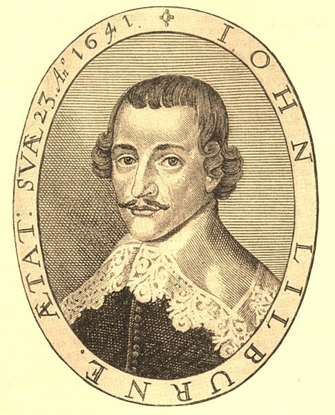
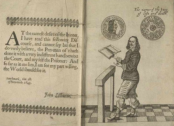
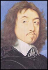 On 17 January 1648 John
Lilburne [left] and John
Wildman [right] addressed a meeting of Levellers
at East Smithfield, with a fierce attack on the House of Lords and
other features of the establishment. For a time during the Civil War
period they were a powerful force, calling for greater democracy and
religious tolerance, but their impact waned by 1650. See here for why the Levellers (and Diggers) were heroes of the late Tony Benn MP.
On 17 January 1648 John
Lilburne [left] and John
Wildman [right] addressed a meeting of Levellers
at East Smithfield, with a fierce attack on the House of Lords and
other features of the establishment. For a time during the Civil War
period they were a powerful force, calling for greater democracy and
religious tolerance, but their impact waned by 1650. See here for why the Levellers (and Diggers) were heroes of the late Tony Benn MP. A suicide's burial
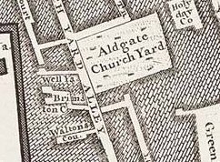
St Botolph Aldgate had a burial ground, consecrated in 1615 in what was later known as Darby Street, on the east side of Church Yard Alley [later Cartwright Street]. John Clerke, the parish clerk, recorded in the parish registers an unusual act of institutional kindness, given the way that suicides were normally treated:
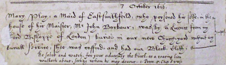  7 October 1616 7 October 1616Mary Play, a Maid of East Smithfeild [sic], who poysened hir selfe, in the house of hir Maister, Mr John Barbour, was (by a Licence from my Lord Bishoppe of London) buried in our new Church-yard, without any buriall Service, shee was coffind, and had our Black Cloth. Be Sober and watch, for your aduersary the Divel, as
a roaring lion walketh about, Seeking whom he may devour. 1 Peter. 5
Chap. 8 verse.
|
 The site was later covered with small houses, plus (in 1846) a charity school and mission established by the Weigh House Chapel.
(This Congregational chapel was originally established in Little
Eastcheap in 1697 over the royal weigh house where the goods of
'merchant strangers' were assessed for custom duty; rebuilt after the
fire of London, it relocated in the 1830s to Fish Street Hill when
London Bridge was built, and then in 1891 to a grand building by Alfred
Waterhouse in Duke Street, off Oxford Street, where it was blitzed. It
had many distinguished ministers, but closed in 1965 and is now the
Ukrainian Catholic Cahedral in London.) Mayhew lists this as a 'Ragged
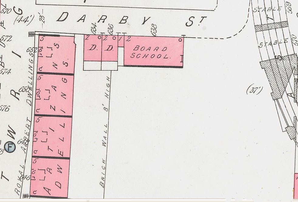
School' in 1849-50. According to Mrs Basil Holmes (Isabella Holmes was the wife of the secretary of the MPGA), writing in 1897, the rookery was cleared by the Metropolitan Board of Works and Darby Street was
made, gravestones and remains being then discovered. The Metropolitan
Public Gardens Association informed the Board of the former existence
of a burial-ground, with the result that what remained of the burial
ground was not built upon, but was made into an asphalted playground,
about 1 acres in extent, for the children of the adjoining block of
tenements. Goad's 1887 insurance map [left] shows a small Board School on this site, to which presumably she was referring, the rest of the site awaiting redevelopment.
The site was later covered with small houses, plus (in 1846) a charity school and mission established by the Weigh House Chapel.
(This Congregational chapel was originally established in Little
Eastcheap in 1697 over the royal weigh house where the goods of
'merchant strangers' were assessed for custom duty; rebuilt after the
fire of London, it relocated in the 1830s to Fish Street Hill when
London Bridge was built, and then in 1891 to a grand building by Alfred
Waterhouse in Duke Street, off Oxford Street, where it was blitzed. It
had many distinguished ministers, but closed in 1965 and is now the
Ukrainian Catholic Cahedral in London.) Mayhew lists this as a 'Ragged
School' in 1849-50. According to Mrs Basil Holmes (Isabella Holmes was the wife of the secretary of the MPGA), writing in 1897, the rookery was cleared by the Metropolitan Board of Works and Darby Street was
made, gravestones and remains being then discovered. The Metropolitan
Public Gardens Association informed the Board of the former existence
of a burial-ground, with the result that what remained of the burial
ground was not built upon, but was made into an asphalted playground,
about 1 acres in extent, for the children of the adjoining block of
tenements. Goad's 1887 insurance map [left] shows a small Board School on this site, to which presumably she was referring, the rest of the site awaiting redevelopment.East Smithfield School
The Parish
Charity School of St Botolph Aldgate was one of the first Protestant
schools of its kind, founded by Zachary Crofton (minister of St
Botolph's during the Protectorate) on a site on Little Tower Hill
c1665, and endowed by Sir Samuel Starling in 1573. It later merged
with another parochial school in the parish, established by
subscription, and in 1905 was amalgamated with Billingsgate and Tower
Wards School as the SIr John Cass Junior School, continuing under this
name.

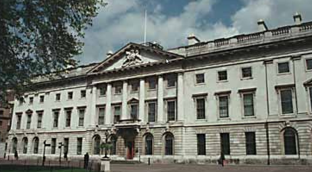
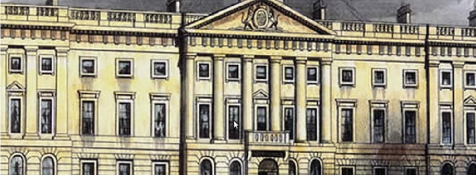 In
1809 the Royal Mint moved
from the
Tower of London (where mechanized rolling mills and coining presses had
been installed in the 17th century) to a site at the end of East
Smithfield, in buildings designed by James Johnson and added to by Robert Smirke,
a prolific architect who also designed the British Museum and a number
of churches in classical style. The impetus for the move was in part
the pressure on space at the Tower following the outbreak of war with
France, but more particularly competition from a private mint in
Birmingham opened by the entrepreneur Matthew Boulton (1728-1809), with
steam-powered machines producing superior coinage and securing
government contracts. A Privy Council committee of 1798 deemed the old Mint machinery to be of ancient and imperfect construction.
In
1809 the Royal Mint moved
from the
Tower of London (where mechanized rolling mills and coining presses had
been installed in the 17th century) to a site at the end of East
Smithfield, in buildings designed by James Johnson and added to by Robert Smirke,
a prolific architect who also designed the British Museum and a number
of churches in classical style. The impetus for the move was in part
the pressure on space at the Tower following the outbreak of war with
France, but more particularly competition from a private mint in
Birmingham opened by the entrepreneur Matthew Boulton (1728-1809), with
steam-powered machines producing superior coinage and securing
government contracts. A Privy Council committee of 1798 deemed the old Mint machinery to be of ancient and imperfect construction. 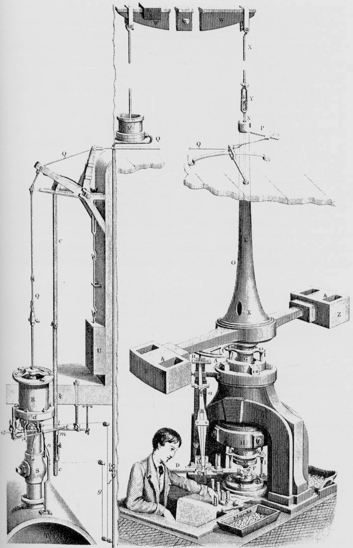
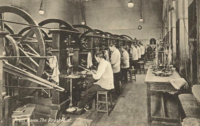
 New premises [site map of 1842 right],
with steam-powered vertical screw machine presses by Boulton and James
Watt (1736-1819), were commissioned [shown in operation in 1866, in an
engraving by Joseph Wilson Lowry]. By
this time the coining-press room (70' long and over 30' wide) contained
a line of eight presses, which operated for up to ten hours a day, each
striking up to 3,600 pieces an hour. The noise was deafening. Boulton's
machines lasted until 1882, when they were replaced and the buildings
redesigned to increase production.
New premises [site map of 1842 right],
with steam-powered vertical screw machine presses by Boulton and James
Watt (1736-1819), were commissioned [shown in operation in 1866, in an
engraving by Joseph Wilson Lowry]. By
this time the coining-press room (70' long and over 30' wide) contained
a line of eight presses, which operated for up to ten hours a day, each
striking up to 3,600 pieces an hour. The noise was deafening. Boulton's
machines lasted until 1882, when they were replaced and the buildings
redesigned to increase production. 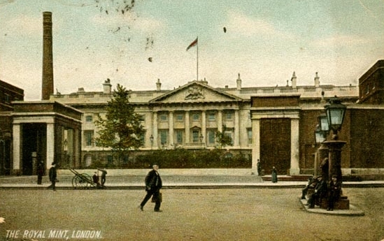
 By
the turn of the century, overseas branches of the Royal Mint were
opened in Sydney, Melbourne, Perth, Ottawa, Bombay and Pretoria. They
were authorised to strike Imperial gold coins, and their combined
output of sovereigns almost equalled that of the London Mint, which had
diversified into providing coinage for the Empire and (especially after
the First World War) other nations. During
the Second World War, the Royal Mint was hit by bombs on several
occasions
(and was put out of action for three weeks at one point). In the
post-war years, it dominated the market for export trade in coinage,
though this later waned.
By
the turn of the century, overseas branches of the Royal Mint were
opened in Sydney, Melbourne, Perth, Ottawa, Bombay and Pretoria. They
were authorised to strike Imperial gold coins, and their combined
output of sovereigns almost equalled that of the London Mint, which had
diversified into providing coinage for the Empire and (especially after
the First World War) other nations. During
the Second World War, the Royal Mint was hit by bombs on several
occasions
(and was put out of action for three weeks at one point). In the
post-war years, it dominated the market for export trade in coinage,
though this later waned.
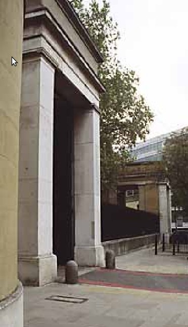 In
the run-up to decimalization in 1971, plans were made to move
production to a new site in Llantrisant, 10 miles north-west of
Cardiff. This began production in 1968 and the last coin at the London
site, a gold sovereign, was struck in 1975. All that remains of the
original buildings is Smirke's east lodge gatehouse. The
site is now occupied by Barclays Global Investors.
In
the run-up to decimalization in 1971, plans were made to move
production to a new site in Llantrisant, 10 miles north-west of
Cardiff. This began production in 1968 and the last coin at the London
site, a gold sovereign, was struck in 1975. All that remains of the
original buildings is Smirke's east lodge gatehouse. The
site is now occupied by Barclays Global Investors.
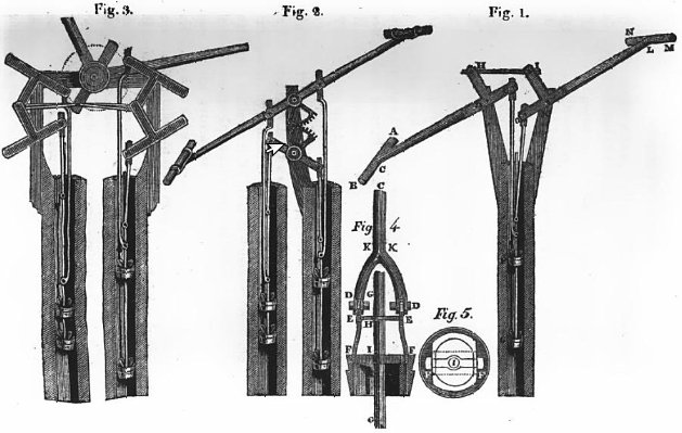 In 1814 Peter Hedderwick, of Lower East Smithfield, was awarded the silver medal and a premium of twenty guineas by the Society of Arts for his design [right] for a double piston pump, yielding double the usual quantity of water from the same bore.
It is thought that he learned the theory of 'ship draughting' from
Robert Steele. He moved to Leith, in Scotland, where he designed a
number of vessels, including a fast sailing smack (for the London to
Scotland run), the schooner Glasgow, and a steamboat for conveying livestock, and published A Treatise on Marine Architecture: containing the theory and practice of ship-building (Edinburgh 1830).
In 1814 Peter Hedderwick, of Lower East Smithfield, was awarded the silver medal and a premium of twenty guineas by the Society of Arts for his design [right] for a double piston pump, yielding double the usual quantity of water from the same bore.
It is thought that he learned the theory of 'ship draughting' from
Robert Steele. He moved to Leith, in Scotland, where he designed a
number of vessels, including a fast sailing smack (for the London to
Scotland run), the schooner Glasgow, and a steamboat for conveying livestock, and published A Treatise on Marine Architecture: containing the theory and practice of ship-building (Edinburgh 1830).
The Docks, and street improvements
See here
for the history of London Docks (begun in 1801) and St Katharine's
Docks
(built between 1824-28 on the site of the Hospital). From that
point onwards, there were various attempts to upgrade the highways - for example, the 1817 East
Smithfield Improvement Bill for altering, amending, and
explaining two Acts of His present Majesty's Reign, for widening and
improving the Street leading from Tower Hill to the Street called
Upper East Smithfield, in the county of Middlesex.
 Progress was slow. Part of the brief of the 1840
Select Committee on Metropolis Improvement was to investigate (in the light of earlier reports) the
opening of a spacious thoroughfare between the populous neighbourhood
of Whitechapel and Spitalfields, and the docks and wharfs of the river
Thames, by widening the northern and southern extremities of
Leman-street, and by creating a new street from the northern side of
Whitechapel to Spitalfields-church [originally called Spital Street, this became Commercial Street].
This scheme involved the widening of East Smithfield to improve access
to the Docks, and of Dock Street as the main north-south access route.
(The area was riddled with courts and alleys with names such as
Harebrain Court, Money Bag Alley, Hog Yard, Black Jack Alley, Black Dog
Alley, Black Boy Alley and Holyday Court.)The evidence presented is here
- see Minutes of Evidence from p17 onwards, in particular questions
230-350 to Thomas Chawner and James Pennefeather (architects of the
scheme) and 351-413 to George Parker Bidder (engineer to the Blackwall
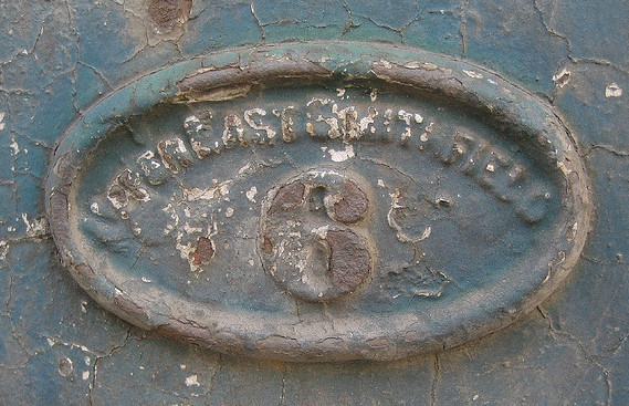
Railway). Right is a Victorian doorplate for 6 Upper East Smithfield. See here for concerns about local sanitation.
Progress was slow. Part of the brief of the 1840
Select Committee on Metropolis Improvement was to investigate (in the light of earlier reports) the
opening of a spacious thoroughfare between the populous neighbourhood
of Whitechapel and Spitalfields, and the docks and wharfs of the river
Thames, by widening the northern and southern extremities of
Leman-street, and by creating a new street from the northern side of
Whitechapel to Spitalfields-church [originally called Spital Street, this became Commercial Street].
This scheme involved the widening of East Smithfield to improve access
to the Docks, and of Dock Street as the main north-south access route.
(The area was riddled with courts and alleys with names such as
Harebrain Court, Money Bag Alley, Hog Yard, Black Jack Alley, Black Dog
Alley, Black Boy Alley and Holyday Court.)The evidence presented is here
- see Minutes of Evidence from p17 onwards, in particular questions
230-350 to Thomas Chawner and James Pennefeather (architects of the
scheme) and 351-413 to George Parker Bidder (engineer to the Blackwall
Railway). Right is a Victorian doorplate for 6 Upper East Smithfield. See here for concerns about local sanitation.
Brewing (continued)
The Red Lion Brewery in Lower East Smithfield stood on the site of the ancient beer house - the 1911 article cited above continues
|
In 1705 the brewery belonged to Alderman Humphrey Parsons [Alfred Barnard Noted Breweries 1889 iii, 53-4], who was elected alderman of Portsoken Ward in 1721, served as sheriff in the following year, and was Lord Mayor in 1730 and again in 1740. The following anecdote is told of him in a contemporary journal:- On one occasion, during his mayoralty, he went out riding with a hunting party which included Louis XV and his suite. He was exceedingly well mounted, and, contrary to the etiquette observed in the French Court, outstripped the rest of the company, and was first in at the death. The king, observing this, inquired the name of the stranger, and was indignantly informed that he was 'un chevalier de malte.' On receiving this information the king entered into conversation with Mr. Parsons and asked the price of his horse. Bowing in the most courtly style, the 'chevalier' replied that his horse was beyond any price other than His Majesty's acceptance. In due time the horse was accepted by the king, and from thenceforward Chevalier Parsons had the exclusive honour and privilege of supplying the French Court with his far-famed porter. In the year 1802 the brewery came into the hands of the Hoare family, and since that time has descended from father to son without changing hands. The Red Lion Brewery is of considerable extent, consisting of a large range of buildings facing the River Thames, and covers 3 acres of ground. The brewhouse is situated in Lower East Smithfield and has a convenient wharf at the river side. The malthouse is the most ancient part of the premises, with its crossbeams and joists of enormous thickness and curious old staircases with broad landings and quaint turnings; the elevator or 'Jacob's ladder' in this building is said to be a hundred years old, but does its work to-day as well as ever. Like many other London breweries, the Red Lion Brewery is supplied with the purest water by means of a well of great depth sunk on the premises. This well has a diameter of 5 ft. to the depth of 100 ft., below which it is carried by two bore-holes, of 12 and 9 in. diameter respectively, 300 ft. down to the chalk. A further supply of water is obtained from the London Clay by ther wells of less depth which are only used in summer, when the Thames water is not cold enough for supplying the refrigerators. Up to the beginning of the 19th century, says Mr. Barnard [op cit iii 58] the peculiar flavour of porter hitherto thought inimitable gave rise to an opinion that no other than Thames water was calculated to produce good porter. This opinion became so general that not only in the United Kingdom but in the world at large, wherever porter was known and prized as a beverage, the genuine brew was considered as locally confined to London. Here, in the oldest brewery in London, Thames water was never used, the supply from the wells being considered superior for mashing and for preserving the intrinsic quality of the beverage. It is a well known fact that up to quite recently the London brewers were not quite agreed among themselves on the process of brewing porter, each pursuing a different road to the same object, and all pretending to some secret with which the others were supposed to be unacquainted. |
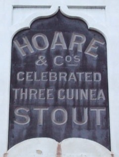
 It was particularly noted for its stouts and sparkling ales. From 1802 the Hoare banking family (see here
for
a member of the family with local connections in the 20th century)
held a controlling interest for the next five generations, and took over several
other small breweries. They were major producers of porter, and ran or
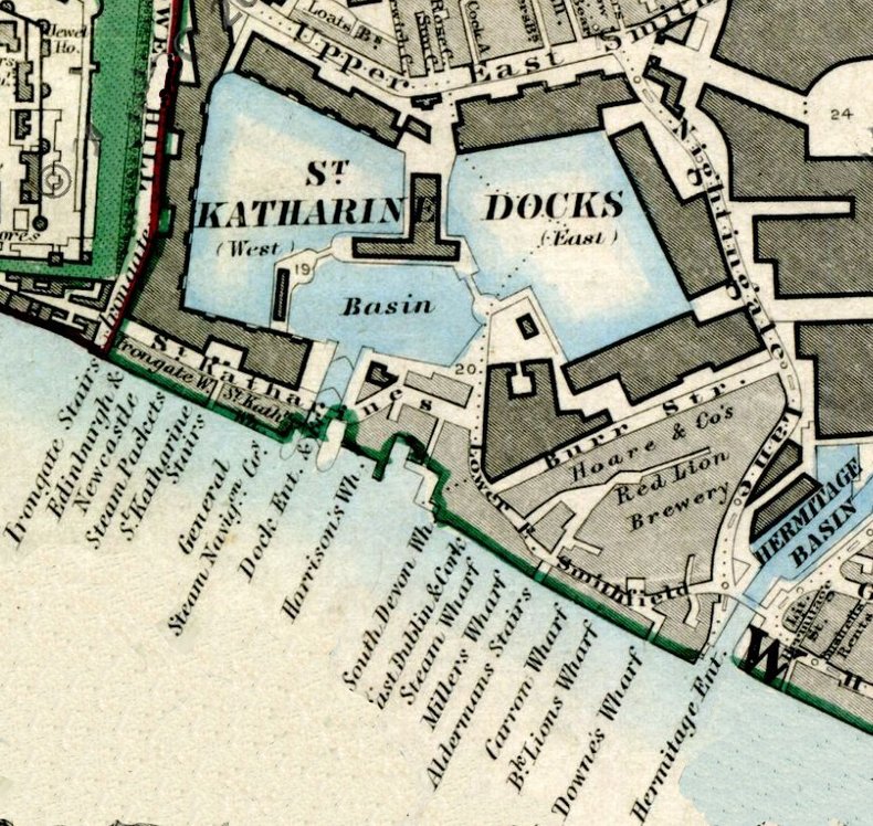
leased many famous pubs in the region. The Red Lion Brewery [map right] closed on
23 June 1934, but
the trademark, a toby jug, lived on in the Bass Charrington logo. See
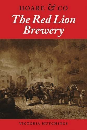
further Victoria Hutchings The Red Lion Brewery (2013). On 5
October 1897 William Booth interviewed its
chairman, William Hoare and recorded his interview in his notebooks (B347 pp217-219):
It was particularly noted for its stouts and sparkling ales. From 1802 the Hoare banking family (see here
for
a member of the family with local connections in the 20th century)
held a controlling interest for the next five generations, and took over several
other small breweries. They were major producers of porter, and ran or
leased many famous pubs in the region. The Red Lion Brewery [map right] closed on
23 June 1934, but
the trademark, a toby jug, lived on in the Bass Charrington logo. See
further Victoria Hutchings The Red Lion Brewery (2013). On 5
October 1897 William Booth interviewed its
chairman, William Hoare and recorded his interview in his notebooks (B347 pp217-219):| W. Hoare. Chairman of the Red Lion Brewery (Hoare & Co.) Lower East Smithfield. Went to see him about (1) The class of men put in by them as publicans (2) The rise in the prices of public houses (3) Views as to the varying policies of licensing bodies. Looks rather a weak man. Has no fixed views or policies to many of the above. The value of the house he said depended on the value of its trade. A trade in spirits is more lucrative than one in beer only. The profit on spirits was about 100%. That on beer only 75%. Publican reckon every month as 28 days and every year as consisting of 13 months. Trade is reckoned as so much per month. All classes of men are put into their houses. there are always a number of applicants among our private connection. Some send their sons to the university. The best men are in the largest houses. The worst in the beer houses. Public houses cater for a public need. If you did away with them, what would take their place? Prices have gone up partly because of the immensely greater stability in the trade. Brewers now see they will not be done away with. When he entered the business 30 years ago everyone was afraid of W. Lawson and his followers. Houses were then no assured source of revenue. Now they are to all intents and purposes. He gave an introduction to one of his publicans. Mr. E. B. Donet of the Hope and Anchor, Hereford St., Lisson Grove, whom he said would be able to tell most about the relations of police and publicans. |
Twentieth century, and today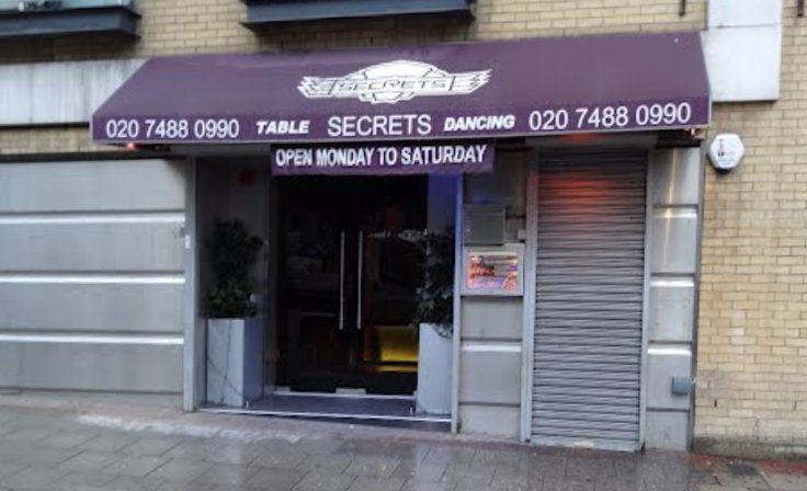

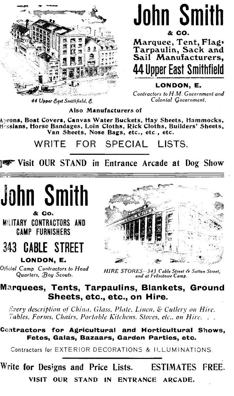 Left is
an advertisement from the 1915 Crufts catalogue from a firm of military
equipment suppliers, based at 44 Upper Smithfield and 343 Cable Street (another similar local firm was Crompton & Thompson, at 157-162 St George's Street);
and right are
men assembling outside the union offices at the time of the 1931 Dock
Strike, and from the present day a table-dancing club...
Left is
an advertisement from the 1915 Crufts catalogue from a firm of military
equipment suppliers, based at 44 Upper Smithfield and 343 Cable Street (another similar local firm was Crompton & Thompson, at 157-162 St George's Street);
and right are
men assembling outside the union offices at the time of the 1931 Dock
Strike, and from the present day a table-dancing club...


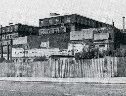
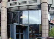
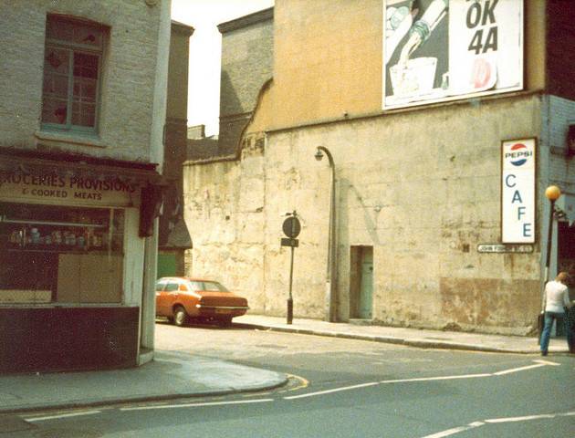 Rebuilding has proceeded apace. Right are
three views from the late 1970s - the top of John Fisher Street (with
Hart's shop on the corner); industrial buildings including a refinery
associated with the Royal Mint (looking north across East Smithfield);
and (looking towards Shearsmith House) a block, never commercially
successful, that was replaced by Admiral House (no.66-68) [far right] which housed the Times Educational Supplement
(formerly part of News International, in 2013 the title was put up
for sale by Charterhouse Capital Partners LLP). Ensign House, next
door, is also due to be redeveloped.
Rebuilding has proceeded apace. Right are
three views from the late 1970s - the top of John Fisher Street (with
Hart's shop on the corner); industrial buildings including a refinery
associated with the Royal Mint (looking north across East Smithfield);
and (looking towards Shearsmith House) a block, never commercially
successful, that was replaced by Admiral House (no.66-68) [far right] which housed the Times Educational Supplement
(formerly part of News International, in 2013 the title was put up
for sale by Charterhouse Capital Partners LLP). Ensign House, next
door, is also due to be redeveloped.