
Public transport in and about the parish
It
is a perilous enterprise to write about public transport, since there
are so many enthusiasts and minutely-detailed websites out there, but
it's part of the story of the parish past and present - affecting where
people live and work, and increasingly house prices - so here goes.
Of course,
for most of the history of the parish people walked
everywhere - to work, for leisure, to visit family and friends - often
covering long distances. Many continued to do so even when cheap
transport, on trains (with workmen's tickets) and trams and buses,
became available, to save a halfpenny or a penny fare. But, as other
pages on this site show, for parish trips and outings to the country or
the seaside, the possibilities of public transport were enthusiastically
embraced.
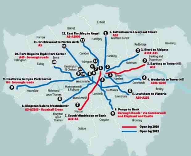
 So was the bicycle,
in a flat area; and this means of transport is
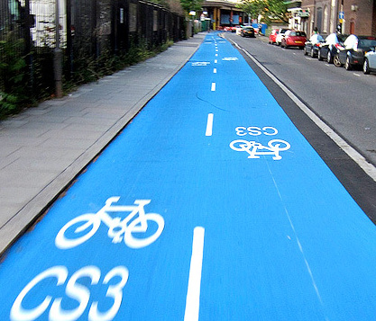
increasingly popular today. In preparation for the Olympics, Cable Street became part of CS3, a Cycle Super Highway from Tower Gateway
to Alfred's Way (A13) in Barking, linking with other routes [map right]. The route was painted bright blue, rather than the friendlier
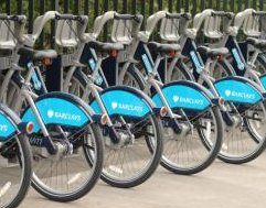
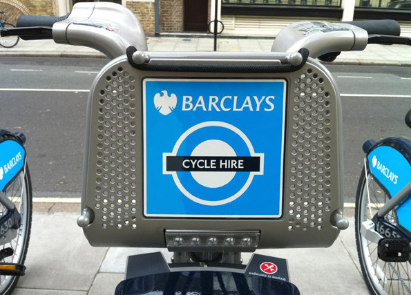
and traditional green, at the behest of Barclays, the sponsors,
who have also underwritten a cycle hire scheme. But the blue has faded,
there are currently issues about future sponsorship of the scheme, and
concerns about the safety of the network where it runs at the edge of
major roads and junctions.
So was the bicycle,
in a flat area; and this means of transport is
increasingly popular today. In preparation for the Olympics, Cable Street became part of CS3, a Cycle Super Highway from Tower Gateway
to Alfred's Way (A13) in Barking, linking with other routes [map right]. The route was painted bright blue, rather than the friendlier
and traditional green, at the behest of Barclays, the sponsors,
who have also underwritten a cycle hire scheme. But the blue has faded,
there are currently issues about future sponsorship of the scheme, and
concerns about the safety of the network where it runs at the edge of
major roads and junctions.
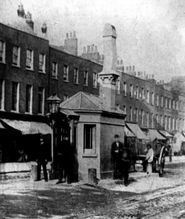
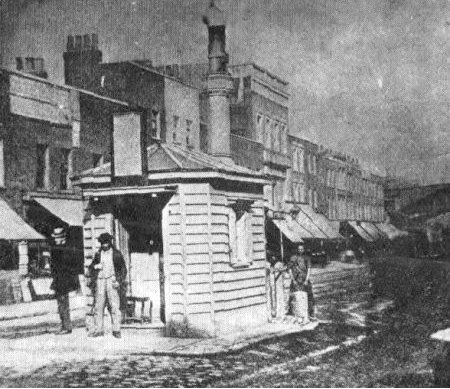
 The Commercial Road
- which eventually became a main artery for trams and buses - was
constructed between 1802-06 by the Commercial Road Company, originally
from Backchurch Lane and later extended to Aldgate, to link the West
and East India Docks with the City. With ruthless Roman-style planning
it cut a straight line through the East End. It was originally a
turnpike road (though was excepted from some of the general legislation
on turnpikes), the Company collecting tolls at several gates and bars
[two shown left].
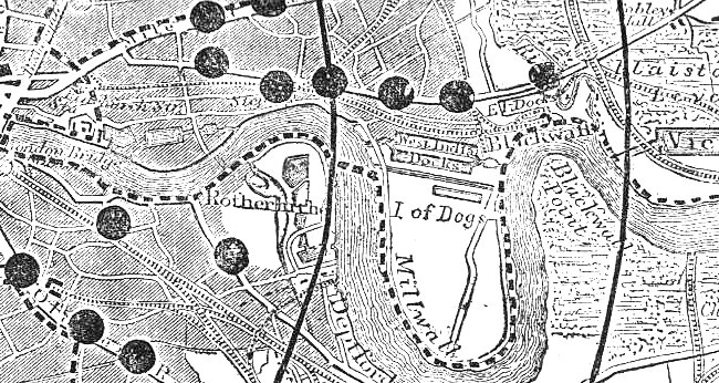
Income from these fell with the coming of the railways, but they became
an anomaly and an increasing nuisance, slowing up traffic, and from the
1850s there were national campaigns for their abolition: left is part of the map from the Illustrated London News
of 1857 accompanying one such campaign. In the event, across the land
most tolls were phased out through the non-renewal of the various local
parliamentary acts; responsibility for the upkeep of the Commercial
Road passed to the new local authority in 1871.
The Commercial Road
- which eventually became a main artery for trams and buses - was
constructed between 1802-06 by the Commercial Road Company, originally
from Backchurch Lane and later extended to Aldgate, to link the West
and East India Docks with the City. With ruthless Roman-style planning
it cut a straight line through the East End. It was originally a
turnpike road (though was excepted from some of the general legislation
on turnpikes), the Company collecting tolls at several gates and bars
[two shown left].
Income from these fell with the coming of the railways, but they became
an anomaly and an increasing nuisance, slowing up traffic, and from the
1850s there were national campaigns for their abolition: left is part of the map from the Illustrated London News
of 1857 accompanying one such campaign. In the event, across the land
most tolls were phased out through the non-renewal of the various local
parliamentary acts; responsibility for the upkeep of the Commercial
Road passed to the new local authority in 1871.
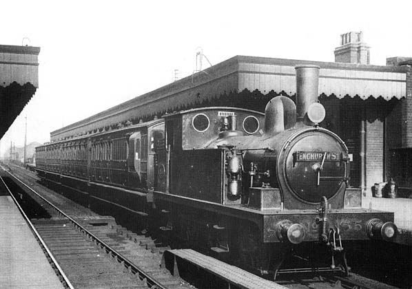
London and Blackwall Railway; London, Tilbury & Southend Railway
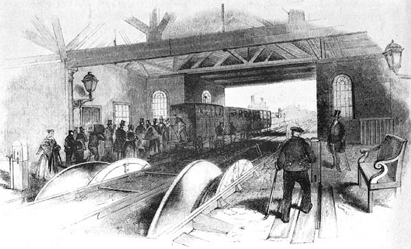 As
early as 1836, Parliament gave authority - despite considerable
local opposition - for the construction of 'The Commercial Railway', to
run 3½ miles on viaducts from Minories to Blackwall, bisecting the
parish from from west to east. Robert Stephenson (son of George)
became the engineer; he had to follow the route, and the eccentric 5'
½" gauge, of his predecessor, but opted for a cable-hauled system with
stationary engines at Minories [left]:
a 7-mile hemp (later steel) rope slipped off carriages at each station
on the outward run and picked them up on return. Because of the fare
for the full journey it became known as the 'Fourpenny Rope'. It opened in 1840; when a new terminus at Fenchurch Street was built the following year, its name was changed to the London and Blackwall Railway. But
the cable system failed; in 1849 the line was converted to standard gauge with
steam engines, lighter than the normal suburban stock, making
possible extensions to Bow and to the London, Tilbury and Southend
Railway. See here for the later history of the Minories station site.
As
early as 1836, Parliament gave authority - despite considerable
local opposition - for the construction of 'The Commercial Railway', to
run 3½ miles on viaducts from Minories to Blackwall, bisecting the
parish from from west to east. Robert Stephenson (son of George)
became the engineer; he had to follow the route, and the eccentric 5'
½" gauge, of his predecessor, but opted for a cable-hauled system with
stationary engines at Minories [left]:
a 7-mile hemp (later steel) rope slipped off carriages at each station
on the outward run and picked them up on return. Because of the fare
for the full journey it became known as the 'Fourpenny Rope'. It opened in 1840; when a new terminus at Fenchurch Street was built the following year, its name was changed to the London and Blackwall Railway. But
the cable system failed; in 1849 the line was converted to standard gauge with
steam engines, lighter than the normal suburban stock, making
possible extensions to Bow and to the London, Tilbury and Southend
Railway. See here for the later history of the Minories station site.
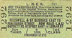
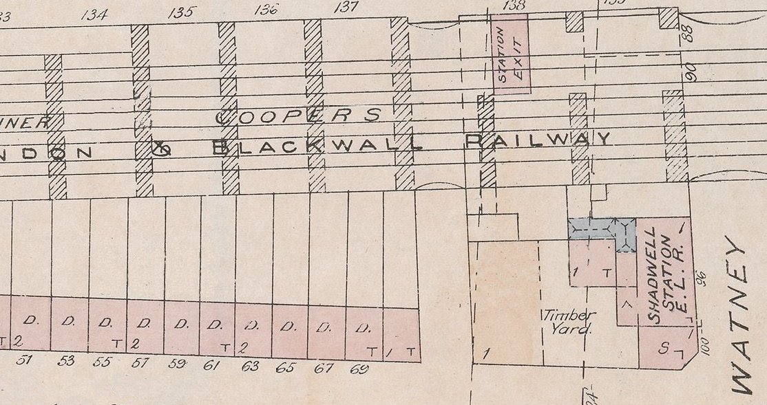
The London, Tilbury & Southend Railway was a joint venture between the London & Blackwall Railway and the Eastern Counties Railway, authorised in 1852 with the first section opened two years later; it initially ran into Fenchurch Street and Bishopsgate stations, but the Bishopsgate service was withdrawn in 1858 when the Bow connection was opened. In the 1880s they constructed a large goods depot on Commercial Road, between Gower's Walk and Lambeth Street, displacing among others Gower's Walk Free School and Mill Yard Seventh-Day Baptists. The LT&SR was purchased by the Midland Railway in 1912, and at the 1923 grouping became part of the London, Midland & Scottish Railway (and hence London Midland Region under British Railways). However, the Great Eastern Railway (of which the ECR had become part in 1862) joined the London and North Eastern Railway grouping (so was part of LNER under British Railways). In 1923 a London to Tilbury train came off the rails, crashed into a parapet of the Cannon Street Road bridge and fell 30 feet.
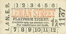
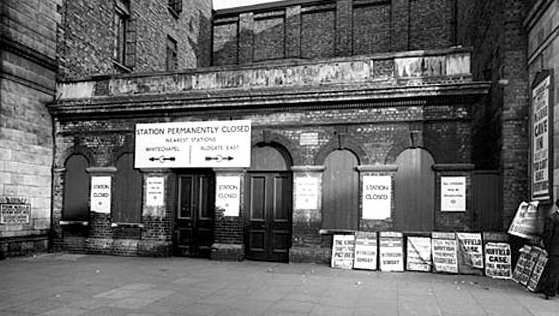
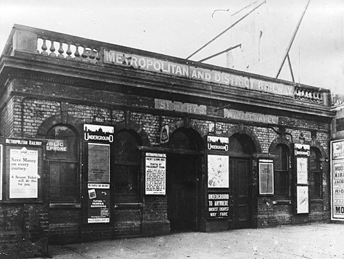
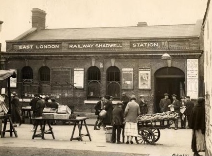
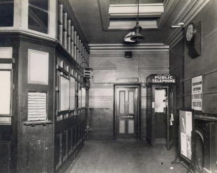
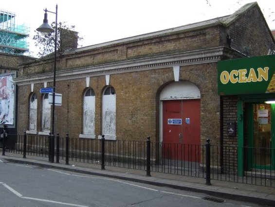
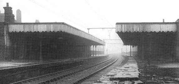 There were
three stations in the parish - Leman Street (1877-1941) [left], replacing Cannon Street Road (1842-48), of which no trace remains, and Shadwell & St George-in-the-East (1840-1941) [right], by Sutton Street, a few hundred yards east of the present DLR station. The railway arches came to house a variety of workshops and other uses - including, as described here,
schools, and houses were built right up against the viaduct, which had
metal railings rather than a brick wall, as this was deemed to be
quieter for passengers and adjacent properties. In
1893 the line from Fenchurch Street to Stepney [now Limehouse] was
widened to four tracks, though soon after traffic declined.
There were
three stations in the parish - Leman Street (1877-1941) [left], replacing Cannon Street Road (1842-48), of which no trace remains, and Shadwell & St George-in-the-East (1840-1941) [right], by Sutton Street, a few hundred yards east of the present DLR station. The railway arches came to house a variety of workshops and other uses - including, as described here,
schools, and houses were built right up against the viaduct, which had
metal railings rather than a brick wall, as this was deemed to be
quieter for passengers and adjacent properties. In
1893 the line from Fenchurch Street to Stepney [now Limehouse] was
widened to four tracks, though soon after traffic declined.
The
lucrative freight market also dictated routes, and there were many
railway warehouses in or on the edge of the parish. A Royal Commission
on Railways, which reported in 1867, considered grievances from the
local sugar trade over what they regarded as inequitable and
monopolistic tariffs, disadvantaging trade in the capital - see here for details. This had been an issue for the parish Vestry for many years; and, as noted here, in 1867 the Workmen's National Executive for the Abolition of Foreign Sugar
Bounties met at Cooper's Hall, off Commercial Road, to continue local protest.
In
recent times, two of the tracks between Tower Gateway and Limehouse
have been used for the Docklands Light Railway with a new
station at Shadwell.
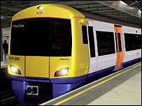
East London Line / London Overground
It began
as the East London Railway, run from 1869 by a consortium of six
companies who took over Brunel's Thames Tunnel between Wapping and
Rotherhithe (built between 1825 and 1843), so it incorporates the
oldest cross-river tunnels on the underground network. A triumph of civil
engineering, designed for horse-drawn traffic, Brunel's tunnel proved a commercial
flop and was only used by pedestrians; but it was strategically
placed to provide a rail service, without the expense of a new river crossing,
 to Liverpool Street and the former Broad
Street stations to the north,
to Liverpool Street and the former Broad
Street stations to the north, It was originally worked by steam – hence the large open ventilation shafts at Shadwell and other stations. See here for its local impact on slum clearance.
The line has been twice closed for extensive rebuilding work in recent times, but reopened in 2010 as part of London Overground. New stations have been built at Shoreditch (unfortunately not connecting with the Central Line, which runs directly beneath) and beyond, via a new viaduct to connect with the old Broad Street lines, and now connects directly to the Overground network at Highbury and Islington in the north. In late 2012 the 'Outer Circle' was completed with trains running to Clapham Junction.


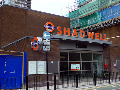
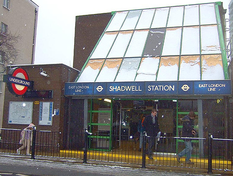
Sarah McMenemy's art work - enamelled panels of local scenes - remains on the platforms at Shadwell. The picture of our church is here, and more examples of her work can be seen here.
With the
re-opening of the line, one pub quiz question came back to life, and one new one was created [answers at the foot of the page]
| Which London Transport
station has no letters in common with the word 'lobster'? At which station does London Overground run beneath London Underground? |
 Old water
troughs at road junctions are a sure sign of historic horse-drawn routes,
some of which are little-changed today. There are none
locally, but long-established routes through the parish nevertheless
remain. They go along Commercial Road, its northern boundary. Although
The Highway is now an extremely busy road, used by many airport
and other coaches, this has only been the case since the opening of
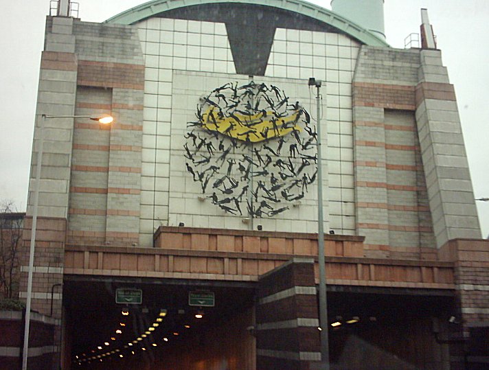
the Limehouse Link tunnel [western entrance right], built between 1989-93 to link the City to
Docklands, and the only TfL bus route to run along it (apart from short
stretches of the D3 and 100) is night bus N551, from Trafalgar Square
to Gallions Reach. This, it is said, is one of several reasons why the conversion of Tobacco Dock into a shopping centre failed.
Old water
troughs at road junctions are a sure sign of historic horse-drawn routes,
some of which are little-changed today. There are none
locally, but long-established routes through the parish nevertheless
remain. They go along Commercial Road, its northern boundary. Although
The Highway is now an extremely busy road, used by many airport
and other coaches, this has only been the case since the opening of
the Limehouse Link tunnel [western entrance right], built between 1989-93 to link the City to
Docklands, and the only TfL bus route to run along it (apart from short
stretches of the D3 and 100) is night bus N551, from Trafalgar Square
to Gallions Reach. This, it is said, is one of several reasons why the conversion of Tobacco Dock into a shopping centre failed.


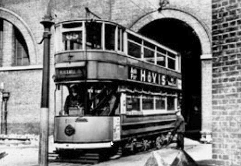
 Electric
trams were introduced to London at the start of the 20th century and
became popular – by 1914 it was the largest network in Europe,
though the First World War, and legal restrictions, halted further
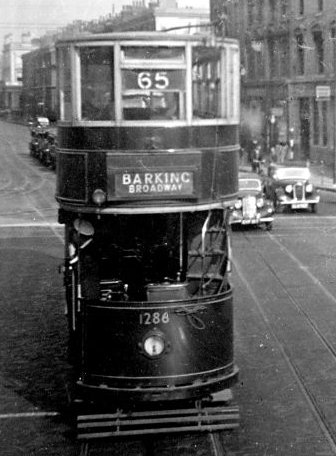
significant growth. Two routes ran from Aldgate along Commercial
Road, the 65 from Bloomsbury to Poplar [despite the tram-blind far right] and the 67 from Aldgate to
Barking. Another route, the 47, ran north-south, from Stamford Hill
to London Docks, running down Leman Street to a 'grim and desolate' terminus in Dock Street,
and was well-used by dock workers. First right is the laying of tracks by Gardiner's Corner, at the junction of Whitechapel and Commercial Roads, in 1907.
Electric
trams were introduced to London at the start of the 20th century and
became popular – by 1914 it was the largest network in Europe,
though the First World War, and legal restrictions, halted further
significant growth. Two routes ran from Aldgate along Commercial
Road, the 65 from Bloomsbury to Poplar [despite the tram-blind far right] and the 67 from Aldgate to
Barking. Another route, the 47, ran north-south, from Stamford Hill
to London Docks, running down Leman Street to a 'grim and desolate' terminus in Dock Street,
and was well-used by dock workers. First right is the laying of tracks by Gardiner's Corner, at the junction of Whitechapel and Commercial Roads, in 1907.
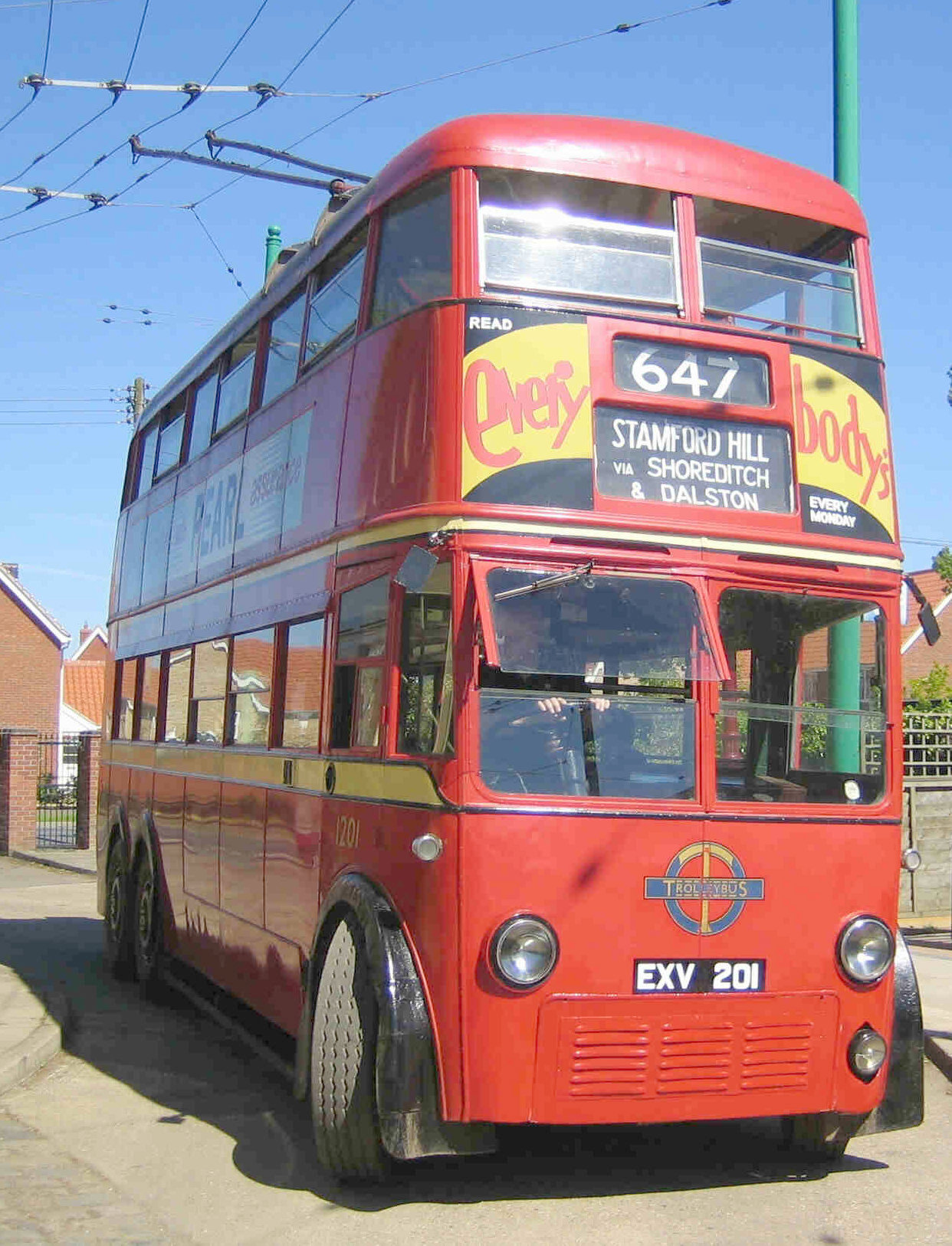
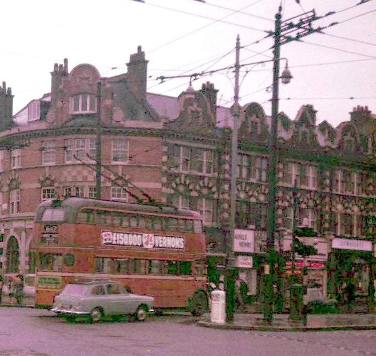
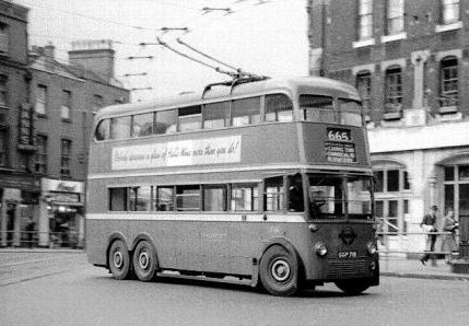 A Royal
Commission in 1931 recommended replacing trams with trolleybuses,
mainly because tramlines and stops in the middle of narrow London streets added to
the increasing traffic congestion. By 1940 half the trams had been
scrapped (compare maps for 1934 and 1940). So the 47 tram became the 647
trolleybus [two views right at Stamford Hill, plus a preserved vehicle at the East Anglia Transport Museum], the 65 tram the 665 trolleybus, and the 67 tram the 567
trolleybus, in line with the numbering system:
A Royal
Commission in 1931 recommended replacing trams with trolleybuses,
mainly because tramlines and stops in the middle of narrow London streets added to
the increasing traffic congestion. By 1940 half the trams had been
scrapped (compare maps for 1934 and 1940). So the 47 tram became the 647
trolleybus [two views right at Stamford Hill, plus a preserved vehicle at the East Anglia Transport Museum], the 65 tram the 665 trolleybus, and the 67 tram the 567
trolleybus, in line with the numbering system:
 The 1924
London Traffic Act had created a system of route numbering, called
the Bassom Scheme, after the chief constable of the Metropolitan
Police, whereby letters were added after the number to denote
part-routes. When London Transport was formed in 1934, the system was
changed again, though letter suffixes continued. Routes 1-199 were
central-area red double decker buses, 200-299 single decker and night
routes, 300-499 country buses south and north of the river, 500-699
trolleybuses and 700-899 Green Line coaches and routes in new towns.
'London Transport' has continued under various names and organisational guises
ever since. (There was reluctance, led by teetotal members of
the London County Council, to allow pub names on bus blinds, so
less-familiar street names appeared instead. Churches, however, do figure.) The 1924
London Traffic Act had created a system of route numbering, called
the Bassom Scheme, after the chief constable of the Metropolitan
Police, whereby letters were added after the number to denote
part-routes. When London Transport was formed in 1934, the system was
changed again, though letter suffixes continued. Routes 1-199 were
central-area red double decker buses, 200-299 single decker and night
routes, 300-499 country buses south and north of the river, 500-699
trolleybuses and 700-899 Green Line coaches and routes in new towns.
'London Transport' has continued under various names and organisational guises
ever since. (There was reluctance, led by teetotal members of
the London County Council, to allow pub names on bus blinds, so
less-familiar street names appeared instead. Churches, however, do figure.) |
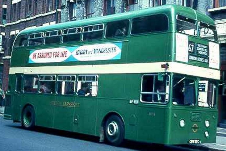 The 567 and 665 routes went in
December 1959, replaced by a new 5 and 5A bus service (later confined
to the eastern parts of the route) and the strengthening of existing
routes 15, 23 and 40. The 647 lasted a further two years, before
being replaced by a new 67 bus route, from the Docks via Leman
Street, Aldgate and Shoreditch up to Stamford Hill and beyond. For a
time it was run by green-painted class XA vehicles [left, running to London Docks], and was extended
to Wapping Station. The 67 route still exists, but now runs only to and from
Aldgate.
The 567 and 665 routes went in
December 1959, replaced by a new 5 and 5A bus service (later confined
to the eastern parts of the route) and the strengthening of existing
routes 15, 23 and 40. The 647 lasted a further two years, before
being replaced by a new 67 bus route, from the Docks via Leman
Street, Aldgate and Shoreditch up to Stamford Hill and beyond. For a
time it was run by green-painted class XA vehicles [left, running to London Docks], and was extended
to Wapping Station. The 67 route still exists, but now runs only to and from
Aldgate.
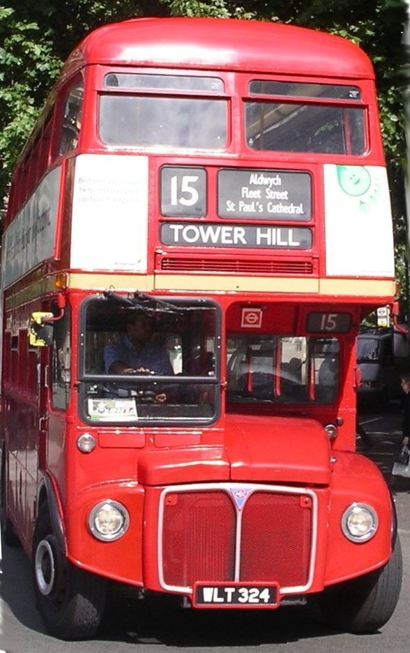
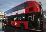
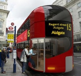 The 15 bus has
run from west to east London through the City and along Commercial Road since 1908,
though both ends of the route have changed many times. Blackwall is now
its eastern terminus, and from August 2010 the western terminus is
Piccadilly Circus. Its route through the City was changed in 1985 to
serve the Tower of London, and this central section is now also run
as a heritage route, with the now-iconic Routemasters [left]. Route 115,
from Aldgate to East Ham, is a 'variant' route of the 15: both are operated by
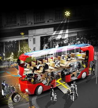
the East London Bus Group. Boris
Johnson, Mayor of London, has pressed for a new-style Routemaster to
replace the single-decker bendy buses, which he abhors; some of these are now in operation [right].
The 15 bus has
run from west to east London through the City and along Commercial Road since 1908,
though both ends of the route have changed many times. Blackwall is now
its eastern terminus, and from August 2010 the western terminus is
Piccadilly Circus. Its route through the City was changed in 1985 to
serve the Tower of London, and this central section is now also run
as a heritage route, with the now-iconic Routemasters [left]. Route 115,
from Aldgate to East Ham, is a 'variant' route of the 15: both are operated by
the East London Bus Group. Boris
Johnson, Mayor of London, has pressed for a new-style Routemaster to
replace the single-decker bendy buses, which he abhors; some of these are now in operation [right].
There are now two local, single-decker, buses running through the parish, plus a third starting just outside, on circuitous but useful routes.
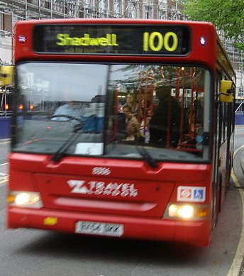
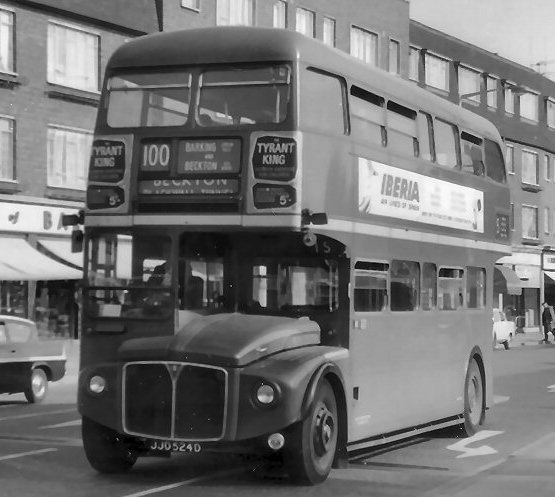 The 100 runs
from Shadwell (Cable Street, outside St George's Town Hall) via
Wapping, Aldgate, London Wall and St Paul's to Elephant and Castle. The
original 100 route, until 1972, was a workmen's bus from Barking
to Beckton Gasworks [right]. It then became the number of various vintage bus
routes through the City and West End. The current service is run by Abellio.
The 100 runs
from Shadwell (Cable Street, outside St George's Town Hall) via
Wapping, Aldgate, London Wall and St Paul's to Elephant and Castle. The
original 100 route, until 1972, was a workmen's bus from Barking
to Beckton Gasworks [right]. It then became the number of various vintage bus
routes through the City and West End. The current service is run by Abellio.
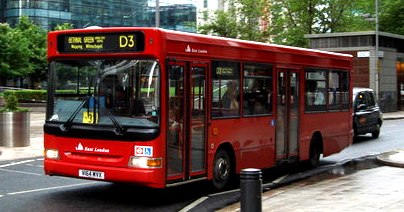
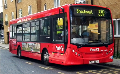 The D3
[left] runs from Crossharbour on the Isle of Dogs, via Canary Wharf,
Limehouse and Wapping and along Cannon Street Road, stopping near the
Royal London Hospital and then via Bethnal Green to the London Chest
Hospital. It is one of a series of 'Docklands' routes and is run by
the East London Bus Group.The 339 [right] runs from Shadwell DLR station through Stepney and Mile End via Fish
Island, Old Ford, and extended to Stratford at the time of the Olympics, and is operated by First Capital. (The original 339
was a 'country' bus between Harlow and Warley.)
The D3
[left] runs from Crossharbour on the Isle of Dogs, via Canary Wharf,
Limehouse and Wapping and along Cannon Street Road, stopping near the
Royal London Hospital and then via Bethnal Green to the London Chest
Hospital. It is one of a series of 'Docklands' routes and is run by
the East London Bus Group.The 339 [right] runs from Shadwell DLR station through Stepney and Mile End via Fish
Island, Old Ford, and extended to Stratford at the time of the Olympics, and is operated by First Capital. (The original 339
was a 'country' bus between Harlow and Warley.)
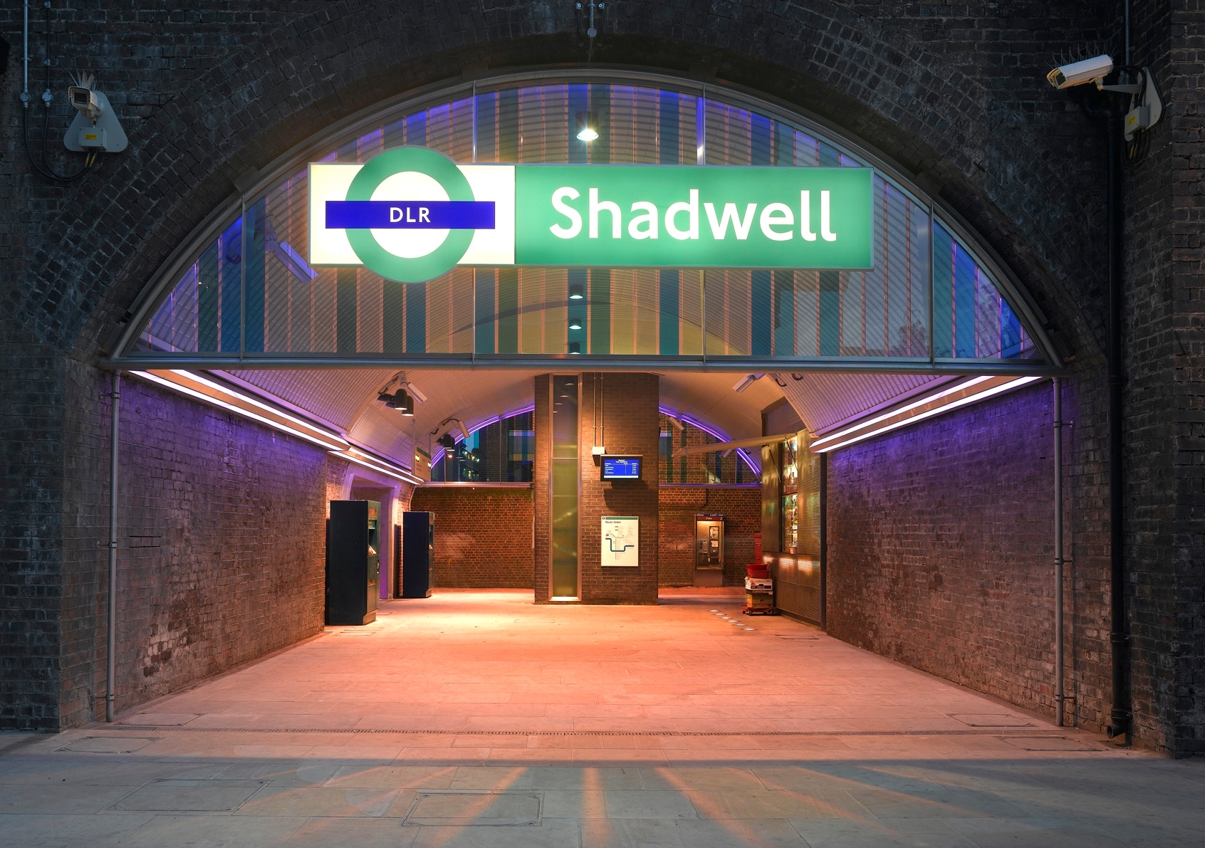
 When Docklands was redeveloped, the search was on a transport system to link it to the City, and the London Docklands Development Corporation chose a 'cheap and cheeerful' light metro system, with driverless trains. Opened in 1987, the original routes of the DLR
were from Tower Gateway in the west, using two elevated tracks of the
former London and Blackwall Railway, with stations at
Shadwell, Limehouse [formerly Stepney] - connecting to the
Fenchurch Street lines - and Westferry, where the line split on new
concrete viaducts to Stratford via Poplar, and through Canary Wharf to
Island Gardens (Isle of Dogs). A western link to the Underground
network at Bank was then created, and there have been several eastern
extensions and new lines. Further western extensions, although tunnels exist beyond Bank, seem unlikely.
When Docklands was redeveloped, the search was on a transport system to link it to the City, and the London Docklands Development Corporation chose a 'cheap and cheeerful' light metro system, with driverless trains. Opened in 1987, the original routes of the DLR
were from Tower Gateway in the west, using two elevated tracks of the
former London and Blackwall Railway, with stations at
Shadwell, Limehouse [formerly Stepney] - connecting to the
Fenchurch Street lines - and Westferry, where the line split on new
concrete viaducts to Stratford via Poplar, and through Canary Wharf to
Island Gardens (Isle of Dogs). A western link to the Underground
network at Bank was then created, and there have been several eastern
extensions and new lines. Further western extensions, although tunnels exist beyond Bank, seem unlikely.
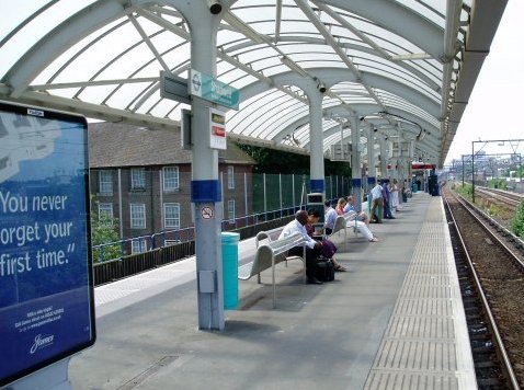
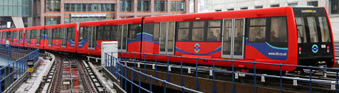
 Demand
quickly outstripped provision: originally run by single-car units,
two-car trains were introduced, and in 2009, to deal with overcrowding,
all platforms were lengthened for the introduction of three-car trains [above], and stations were upgraded in other ways. Left are the platforms and the façade at Shadwell. The
system is run by Serco Docklands Ltd, under a concession from Transport
for London, and is part of the Oyster network, providing through travel
on other TfL lines, now including London Overground.
Demand
quickly outstripped provision: originally run by single-car units,
two-car trains were introduced, and in 2009, to deal with overcrowding,
all platforms were lengthened for the introduction of three-car trains [above], and stations were upgraded in other ways. Left are the platforms and the façade at Shadwell. The
system is run by Serco Docklands Ltd, under a concession from Transport
for London, and is part of the Oyster network, providing through travel
on other TfL lines, now including London Overground.
Crossrail
is a major scheme for an additional underground rail route crossing
central London to relieve congestion on existing lines, and extending
above ground to the east and west. At Whitechapel (interchanging with
existing lines) it will diverge to Stratford and beyond to the north,
and via Canary Wharf to Abbey Wood and beyond in the south. It will not
therefore pass through the parish, but when completed will certainly
have a major impact on local infrastructures.
Back to Home page | Back to History page | Back to Cable Street | Back to Tobacco Dock PUB QUIZ ANSWERS: Wapping and Whitechapel